Quality marketing media and captivating online presentations
From private homes to hundreds of acres of land and whole islands. We help getting them sold in no time.
From aerial video footage and photo images to interactive maps, project websites and online presentations we specialise in producing quality media content for real estate online and offline advertisement that brings exposure and catches attention of the right audience.
Every property is unique so are our projects.
We put significant efforts, experience and skills in producing sharp vibrant images and video presentations that make your property outstand.
Bellow there are some examples of what and how we do.
Make your online advertising truly outstand
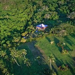
Small property showcase
It is important to have the property outstand in a long list of other offers when it advertised online.
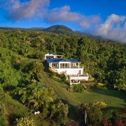
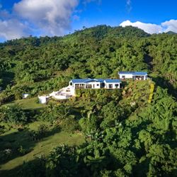
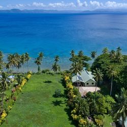
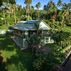
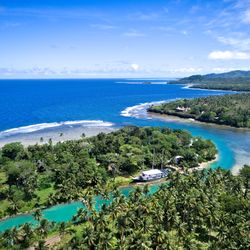
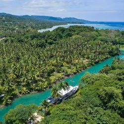
Sautu, Soqulu, Taveuni
The property was sold by the owners themselves in less than a couple of months after they distributed the video through their channels. With the only purpose of selling their house faster, they created their own YouTube channel and with only a few followers and two videos at that time our video collected for them 41k likes and brought them a direct buyer. Quite remarkable achievement. Especially for a property located quite remotely.
Sautu, 2021
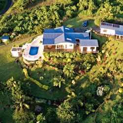
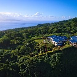
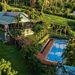
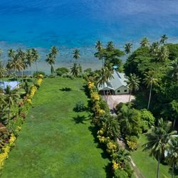
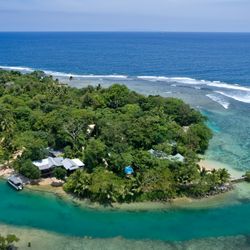
Wai Savu Rua, Soqulu, Taveuni
Another beautiful property in Taveuni. Video was produced in 2021 for Australia based client.
Wai Savu Rua, Soqulu, Taveuni
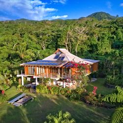

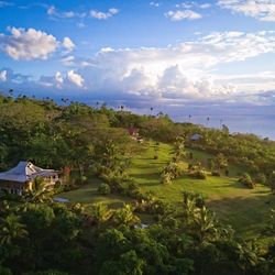
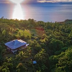
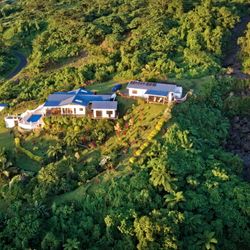
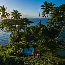
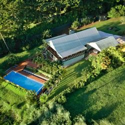
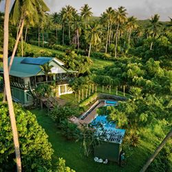
Vatulaga, Taveuni
Another success story. After posting the video through our channels this beautiful cosy house with incredible views was sold in 3 weeks. While still working on the property online presentation, we were called by the owner who informed us that they got a commited buyer.
Lot 3 Vatulaga
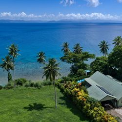
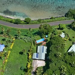
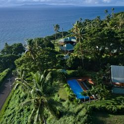
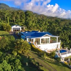
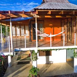
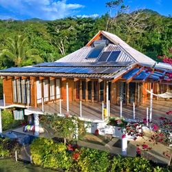
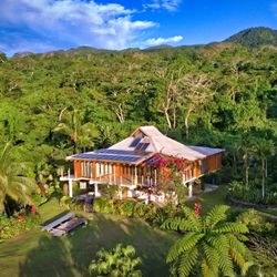
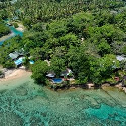
Soqulu, Taveuni
Another property in Soqulu, Taveuni. The owner provided us objectives to give the house proper "all around" close look but also show that it is not the only lonely house in the in the neighbourhood. A set of high quality still photo images from the air and from the ground was also produced for their 'for sale' listing.
Better to see it once than hear a hundred times
Aerial Video & Photo Inspection
15 years ago you'd need to hire a helicopter with a pretty skilled pilot and professional cameraman on board in order to do an observation flight of a relatively large piece of land before buying it.
Clients, who order an aerial inspection nowadays pay a fraction of what the helicopter observation flight would cost. They already have some ideas of what's the place look like, they alreay interested, but need more detailed visual information to have complete picture.
Aerial inspection video usually plays longer than promotion video that made simply to quickly grap attention of potentially interested audience.
It comes especially handy for relatively large parcels of land where foreign investors, who alreay interested in buying it, want to properly see it in details before commiting the purchase.
We also provide regular aerial inspections on subscription basis weekly, monthly, quarterly or annually. In some cases they can be indispensable for owners of particularly large property when they need to regularly monitor from a far on the ground activity, their project development progress or potential encroachment or illegal activity in hard to access parts of the property.
Small size land
Soqulu, Taveuni
This video focused at just 3 acre lot of land that client from the US bought in Soqulu, Taveuni. They wanted to know what's the land actually look like, what is around and based on that make their plans regarding it's development. We also provided georeferenced photo map, digital surface and terrain models and elevation data.
Medium size land
Vacala Beach, Taveuni, Fiji
Aerial inspection of 20 acre parcel of land. Even though the size of the land seems relatively small. It posed some challenges as the lot was pretty narrow, but also 2km long.
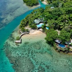
Natuvu Point, Vanua Levu, Fiji
Aerial inspection of an 80 acre parcel of land at Natuvu Point, Vanua Levu, Fiji. In this project US based potential buyer wanted to see the whole land, the beachfront and the surroundings.
Large size land
The series of video bellow was produced for Natewa Bay Resort project and consists of 5 videos.
Making observation and inspection flight for a land of such scale is a challenging task that takes good deal of planning and preparations. There are lots of things to see on 580 acres. Especially if you have it all there: a river, a lake, a beach, the ocean, and the mountains. It is impossible to show and fit everything in a typical 3-5 minutes short video compilation. So we divided everything into five parts.
First video - the presentation video, provides general outlook over the area, briefly featuring different parts of it. Unlike other long videos in the list, that take you around the vast 580 acres paradise at slower pace, the short presentation video made with purpose of quickly grabbing attention of a potentially interested viewer. An interested viever invited to view more focused videos featuring different parts of the property in details.
Project presentation video
The Beachfront
Beachfront and mountains
in the mountains
The Salt Lake
Presentation for potential investors
Large Property Presentation
We understand that real estate properties and projects of certain level do need extra support to outstand and catch attention of the right, capable audience.
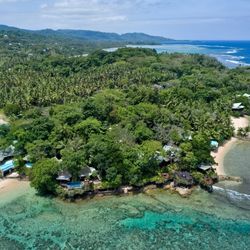
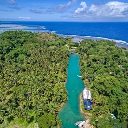
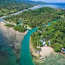
Savasi Island was a complex project that involved creating a full set of marketing media including aerial video, images, aerial mapping and full scale project presentation to be published online and easily accessible by anyone interested to study the opportunity in details also to be easily viewed and shared by real estate agents and potential investors.
You can view the full presentation following this link: https://savasi.maphub.online
Bellow are some video and photo samples from Savasi Island project we completed in 2023
Video footage
High quality video presentations show potential buyer not only the property itself, but also the whole area around, providing good understanding of what the surroundings like and how actually far things like major roads, amenities are, what the terrain like and how actual neighbourhood looks.
Savasi island presentation video
Unique investment opportunity
Aerial still photo images
Bellow are some aerial imagery samples we did for Savasi Island. Full photo collection you can view on the project page.
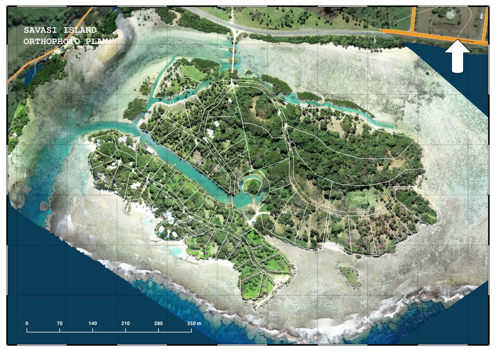
Interactive Map
We digitise land boundaries and subdivisions using valid online and offline data sources, laying boundaries precisely over the world georeferenced photo map and terrain models. You can zoom such interactive maps in and out, viewing it in such details that you be able to count leaves on trees having true and precise information of where on Earth the boundaries actually located.
If you find Google Maps satellite map quality pretty poor for the area you want to show the potential buyer, we can produce a survey grade accuracy, high resolution photo map, that will cover the area of interest in tiny details.
Using easy to use tools in our very own online mapping app the client can do basic measurements and land planning right from the comfrot of their home without having to get licensed surveyors involved on the initial stage of self examining the land and making their further plans.
This map was created in MapHub. You can open it in a separate window for detailed and more comfortable viewing.
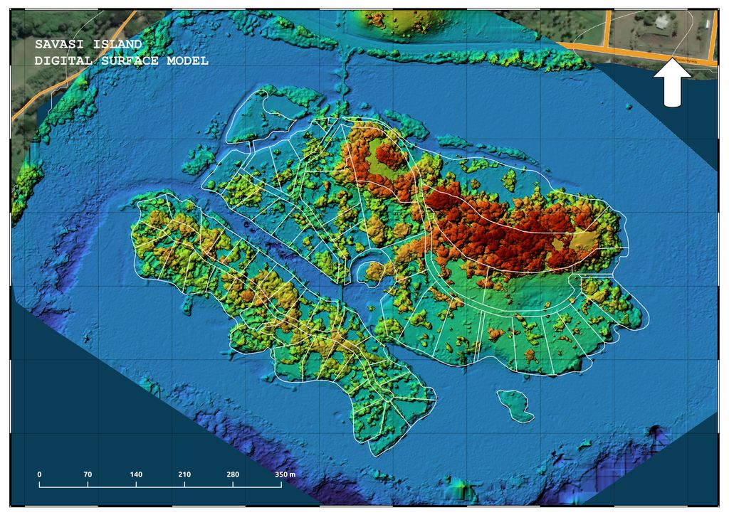
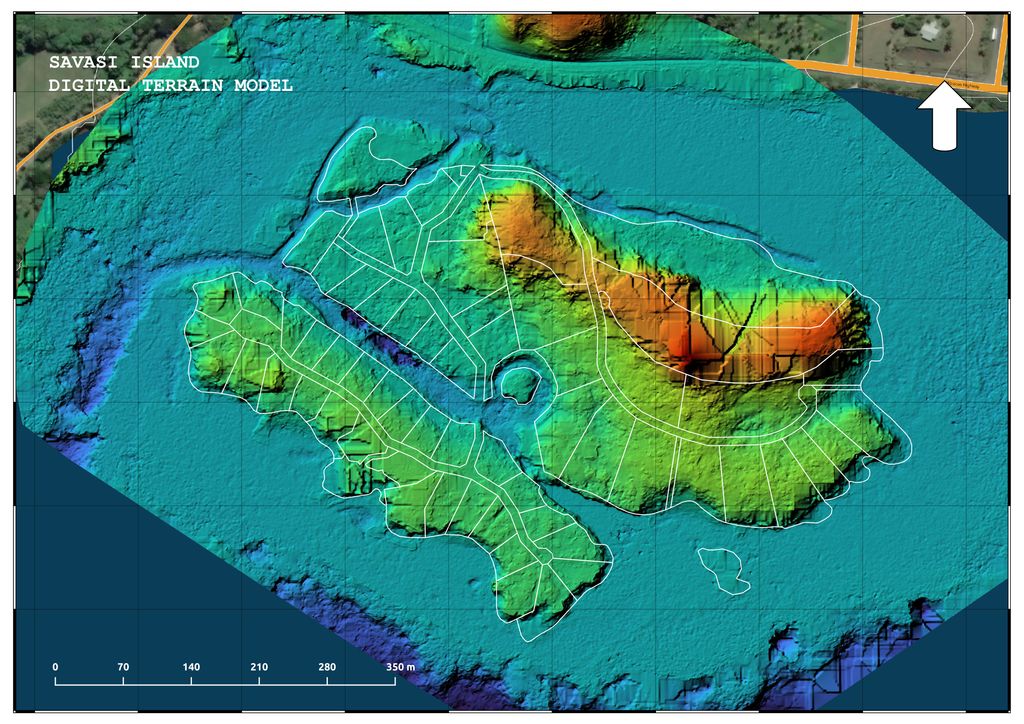
Aerial Mapping and terrain analysis
Creating geographically referenced photo map and terrain reconstruction as a part of the presentation help potential buyer to understand better what the property's surface actually like, where and how much of the tree canopy present on the land, how smooth, rough, hilly the terrain profile looks and how surface features distributed inside the boundaries, that geographically accurately laid over the photo map and coloured surface and terrain model images.
Gives it the quality of international exposure
Property and developer projects dedicated website
Having our own in-house web development, mapping and content production we are able to efficiently produce real estate industry specific websites and presentations.
From project and property for sale online presentation single page websites, to full scale real estate classified listings websites.
There are some very recent completed works:
Savasi Island - Unique Investment Opportunity
Natewa Bay Resort Investment Project
Get in touch using the contact details bellow to discus your project and how we can help.
Vibrant, modern, easy to use
We turn old paper maps and surveyor plans into digital assest.
Old surveyor paper plans, ancient looking property maps. We take them and turn into modern colourful presentatinal materials.
We take exact geographical coordinates of the land boundaries and visually appealing lay them over the world map, aerial photos and videos.