Fiji iTaukei Native land aerial mapping
iTaukei native land aerial mapping sample
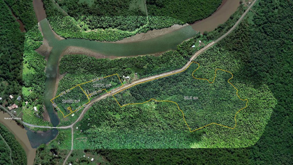
Aerial photo map of 150 acres of iTaukei native land. Surveyed by TLTB and by Northern Frontiers SAS digitized boundaries data overlay. Bellow is the whole story of how it was produced.
This map was created in MapHub. You can open it in a separate window for detailed and more comfortable viewing.
First there was the word
The task
April 7 2024, Nadi, Fiji
A local client contacted us.
They have leased relatively large 17 hectares (about 42 acres) of iTaukei native land through TLTB and requested an aerial video observation of the asset.
The purpose: To understand what is currently present withing the boundaries of their land, what kind of terrain, surface, vegetation, possible access to the natural water sources, possibility for farming and other activities defined by the lease conditions, development planning and so on.
The insights of such depth always based on objective data not on bare visuals only, but it is natural for a land owner wishing to see the land with their own eyes.
They could go and try to walk around dense vegetation themselves in search of answers to their questions, but there are easier, faster, time and resources efficient ways to achieve that. Aerial mapping combined with video and photo observation provides landowners complete strategic outlook.
After brief analysis of the initial information available, we discovered that the location of the land was in quite flat area, significantly overgrown and hard to access for detailed "on the ground" inspection.
An aerial video observation seems like an obvious, first "go to" option, but what it actually gives except scenery views? Not much.
In such cases we suggest first to map the total area the land takes and some adjacent area around.
Why do you need your land mapped?
The major strong advantage of aerial mapping in compare to video and photo observation, you get highly accurate and detailed static picture of the whole land that is geographically referenced and laid over the world map with added boundaries and other valuable geospatial information.
For a Fiji landowner or lessee, having an aerial map of the land is essential. Aerial geospatial data helps to inspect every inch of the land themselves, count every tree and plant on the ground, dalo or kava plants for example, detect specific type of trees and plants, water sources, water courses, easily detect possible squatter settlements, farms, encroaching and other activities and abnormalities.
You can see some samples of land mapping here
What is wrong with videos?
With simple video observation only you get nice looking aerial view in motion and some very basic visual information without any geospatial context. There is little to none of practical use of such video or photo for a land owner, apart from adding some ukulele tunes and make music video presentation for YouTube.
So aerial mapping it is! Where do we start?
The story bellow describes how we proceed with iTaukei native land aerial mapping in Fiji.
The whole process split in 4 typical stages that we go through while taking on most of our mapping jobs. So the story bellow was written for a land owner and a potential client to better understand what drone aerial mapping actually is, what we might need from you, what it takes to complete such task and what kind of result we deliver.
Lets go!
Study where is it, what is it and what is around
Stage 1: Defining the area
We need the boundaries!
First thing we need to know is where exactly the land is and what precisely are the boundaries.
Initially all the information the client and us had about the land was this screenshot from Google Maps saying "it is somewhere here"
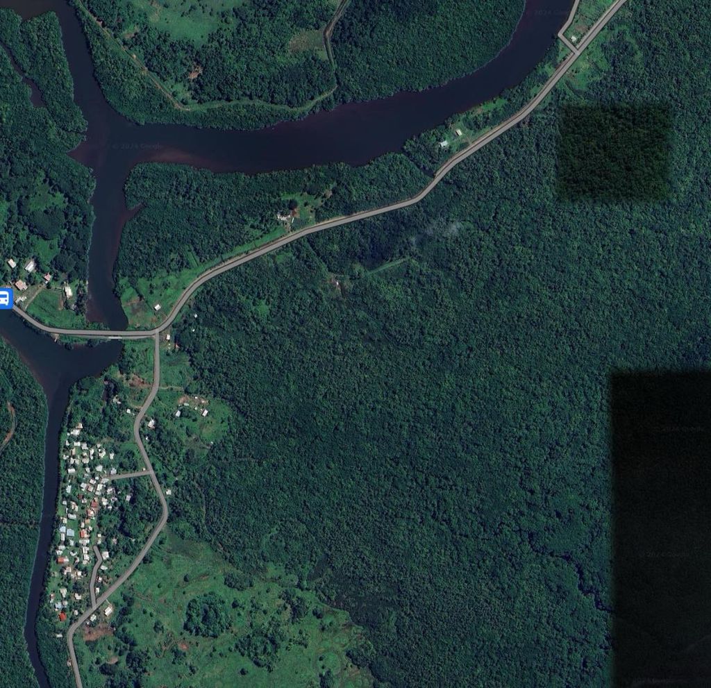
And a scan of paper survey plan with boundary drawings and pegs coordinates in FMG (Fiji Map Grid system) used by surveyors in Fiji. Nothing else.
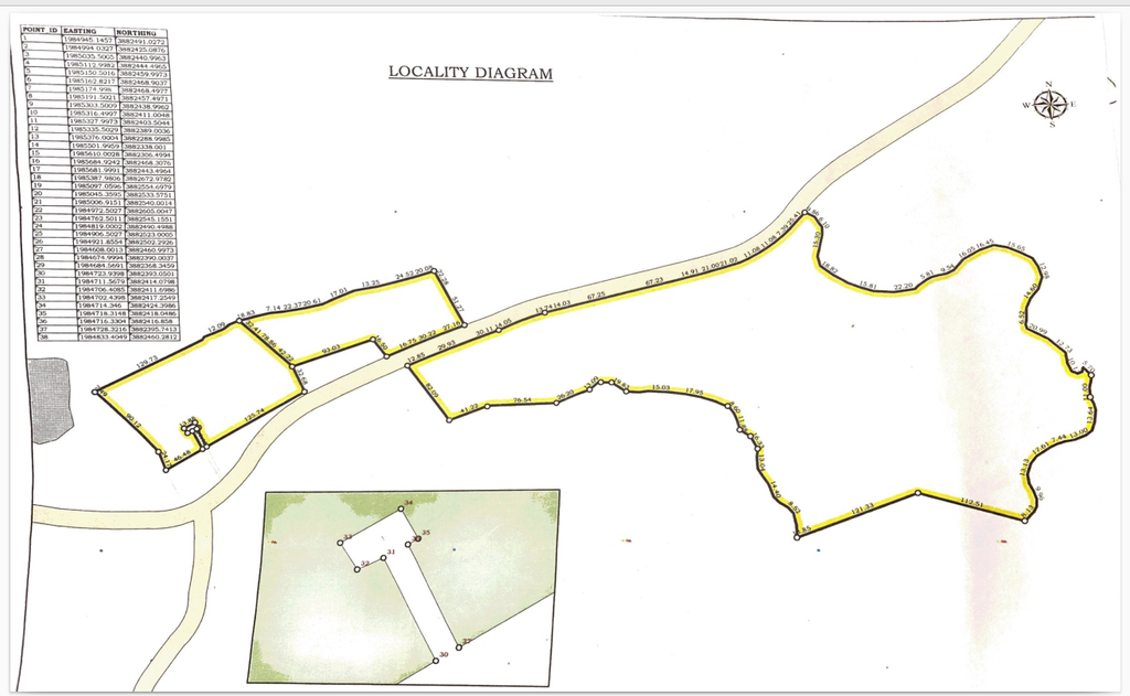
So having only that information we will have to identify the location of the land and boundaries. Using pegs coordinates we should be able to digitize and reproduce the land boundaries in digital format, suitable to use in various GIS and CAD software providing us precise location of the land in world coordinates.
After manually processing pegs coordinates from title survey plan we get this awkward shape that only slightly reminded the boundaries line from the title.
Obviously it should not be like that, but it is what it is. Apparently there was some inconsistency in coordinates details in the title papers so we had to fix it ourselves.
Eventually we have digital boundaries of the land as much accurate as the boundaries coordinates details in the survey plan suggest. Not entirely as it looks in the title survey plan but here we rely on objective data from coordinates table not only the look of the boundaries as someone drawn them on paper.
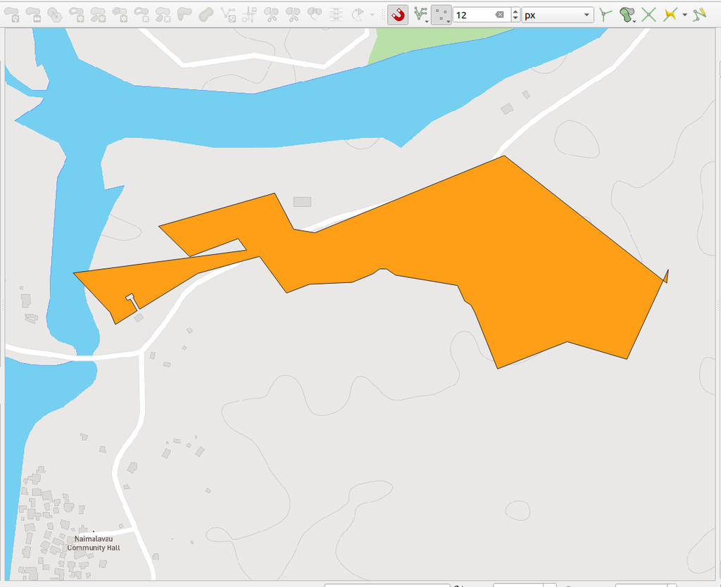
And here we have the final result of the boundaries projected on the world map. What it was and what it became.
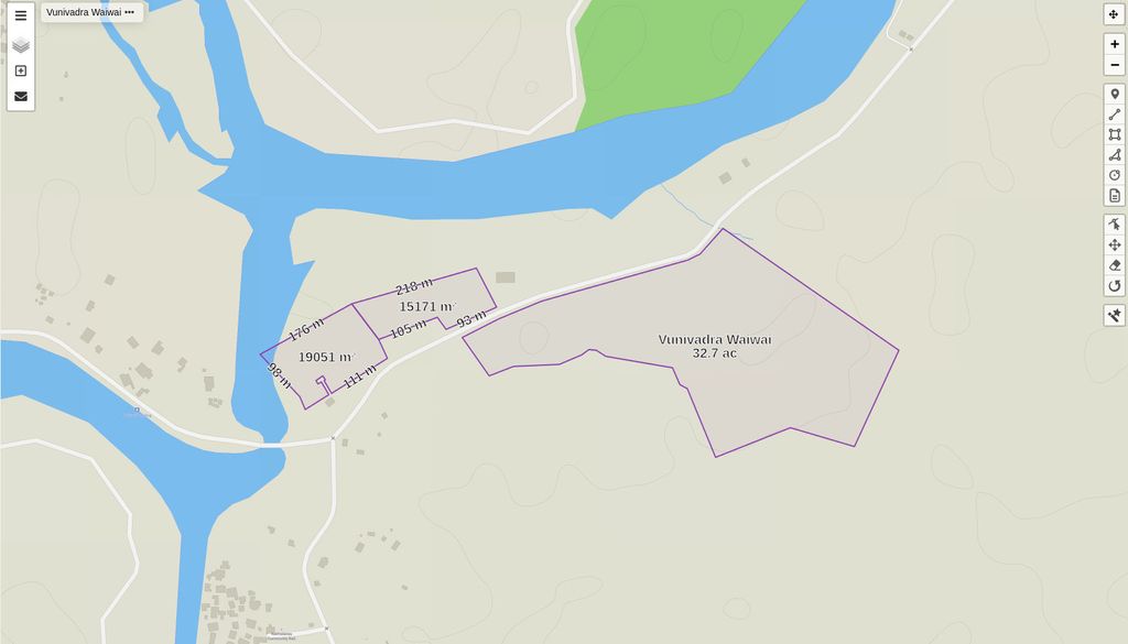
Vunivarda Waiwai map digitized boundaries
Live map that can be shared and viewed online. Push "View this map in MapHub" button for best experience. Red line is the boundaries of the proposed total mapping area. So we not only map the land withing it's boundaries but also some area around it for reference.
This map was created in MapHub. You can open it in a separate window for detailed and more comfortable viewing.
See it with your own eyes
Stage 2: Reconnaissance
Aerial mission success, especially committed far from the HQ greatly depends on quality of reconnaissance.
Before we move to the drone flying stage we must see the place with own eyes. That's the law. Understand possible challenges, define operation spots, talk to landowners and neighbours receiving valuable information and informing them about coming soon drone flying above their land.
Talking to locals gives us good insights about the land, the best possible operation locations that we might not be aware were existing, foresee challenges, observe the sky above the area and understand the best ways to approach the task.
During the first visit we also record logs for our GNSS base in order to process PPP (Precise Point Positioning) coordinates for best possible accuracy of our mapping.
May 11 2024, Nadi, Fiji
It was quite early 6AM start and long driving from Nadi to Nausori, spending some time at the site, checking the area, making connections with residents and taking notes useful for mission planning.
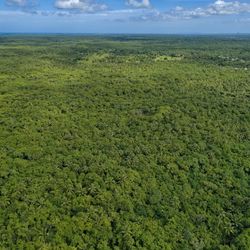
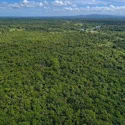
Aerial visuals
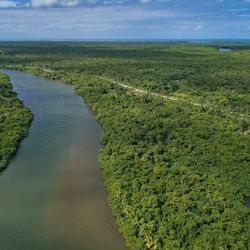
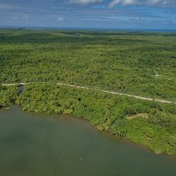
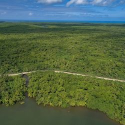
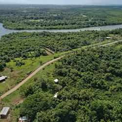
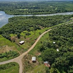
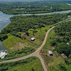
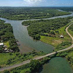
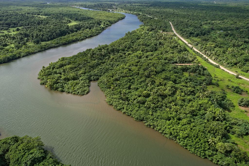
Aerial photo and video visuals complete the picture providing simple and efficient way to overlook the territory around, the surroundings and look at the land from different angles and perspectives only the birds and pilots usually see it.
The complete video observation flight around the boundaries of the land usually taken at the reconnaissance stage to test reliability of controller reception and obtain valuable visual material for better planning of mapping mission stage. It also provides valuable images for a client that they can use for development planning or marketing later.
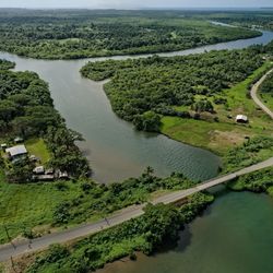
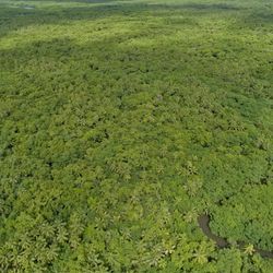
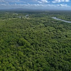
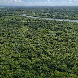
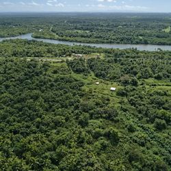
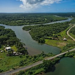
Vunivadra Waiwai, Nakelo District, Fiji, 4 km south east of Nausori Airport
Overlooking flight of 150 acres of Fiji iTaukei native land as an additional aerial visual material to mapping project for native land lessee. 100m altitude, 10 to 15 m/s cruising speed. With a bit of editing and a sound track so it would be more fun watching.
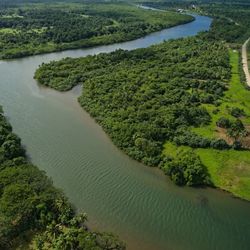
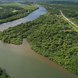
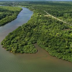
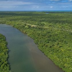
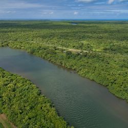
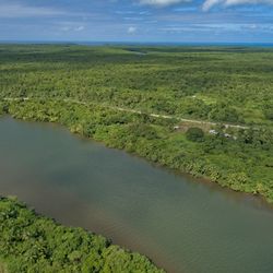
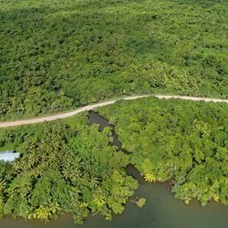
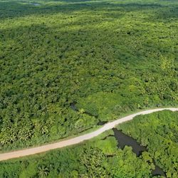
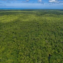
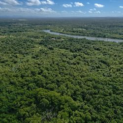
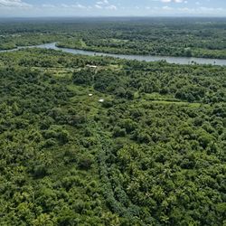
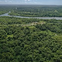
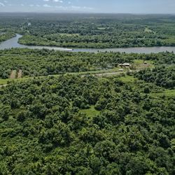
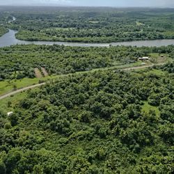
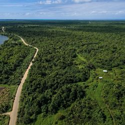
Aerial photography
This aerial photography done as a part of aerial visual collection for the client and as a visual assistance in aerial reconnaissance preparing for mapping mission.
Sky is always the limit
Stage 3: Data collection
The shortest in time, but most exiting and important part of the mapping project
June 19, 2024
Vinivadra Waiwai, Nakelo District, Tailevu, Fiji
For a number of reasons it took a while to get everything going. A number of pieces of a puzzle have to be set right. The right weather that requires as less wind as possible, no rain and no strong solar storms
But eventually everything was set right and we left Nadi around 6AM on June 19, crossing the main island literally in 4 hours from the West to the East, arriving at the East side at around 10:15 AM. We greeted the residents, had quick breakfast with a sandwich and a cup of coffee and started preparing for the mission. Setting up GNSS base station to record the logs, deploying drone launch pad, setting up and arming the drone, contacting Nusori air traffic control tower for clearance.
After clearance was given we were in the sky at 10:55AM proceeding with the mission at 100m altitude above ground level.
Once we are in the sky, there is no a second to waste. Battery charge constantly going down and every minute wasted is a 300m long strip of map not being done. So getting in the air prepared is a quite important part. There are lots of things to check and get sorted before taking up in the sky.
Speaking of this particular project, in order to fly 100m altitude we had to apply for CAAF permission as the operation zone lays right in the descending path for flights coming to Nausori International airport and DJI limits the altitude there to 60m only. Unauthorized operator will not be able to physically fly above that limit and we must know about that before coming otherwise our mission will likely fail and and we will have to come again. Such things happened earlier teaching a good lesson.
In order to get the hardware unlocking license from DJI we must to apply for it online and provide valid permission letter from local Civil Aviation Authority. In Fiji it is CAAF. Such permissions only given to insured, approved and authorized drone operators in Fiji and to become one that would be a dedicated story to tell on it's own.
So it takes about a week of waiting and organising to get all the paperwork sorted for such job in order to fly at 100m altitude near the airport.
Once it all sorted we are clear to go.
The whole fieldwork for such map of 150 acres takes approximately 2 hours to complete. That includes drone preparation and setting up time, calling Nausori airport tower for clearance and executing 3 flights approximately 20 minutes each.
The drone took 833 high resolution photos of the area that later to be processed on a powerful computer and used to "stitch" the whole 150 acres area map as one solid piece.
The very important part here is to do it all right from the first try. Sharp focus, right exposure, right shutter speed, right aperture, ISO, drone speed and altitude and number of other factors that have to be right in order to get high quality dataset and as a result high quality map of the area. One mistake and everything will have to be re-done again.
Stage 4: Processing the deliverables
The final stage of the mapping project is processing the actual maps
After field work is done and data has been collected, it forms so called dataset that used to produce the actual map of the area and the collection of other "deliverables" such as Digital Surface Model, Digital Terrain Model, 3D model, Point Cloud and so on.
It takes some serious computation power and hours of a mighty computer making sweat processing heavy imagery.
Before it even started we use special Post Process Kinematics software to write coordinates corrections to every single image out of 833 in order to make our map as much accurate as possible. The absolute map accuracy usually varies between 15 and 50 cm depending on dataset quality and various factors affecting data collection process.
The raw results used to produce various useful geo-referenced images.
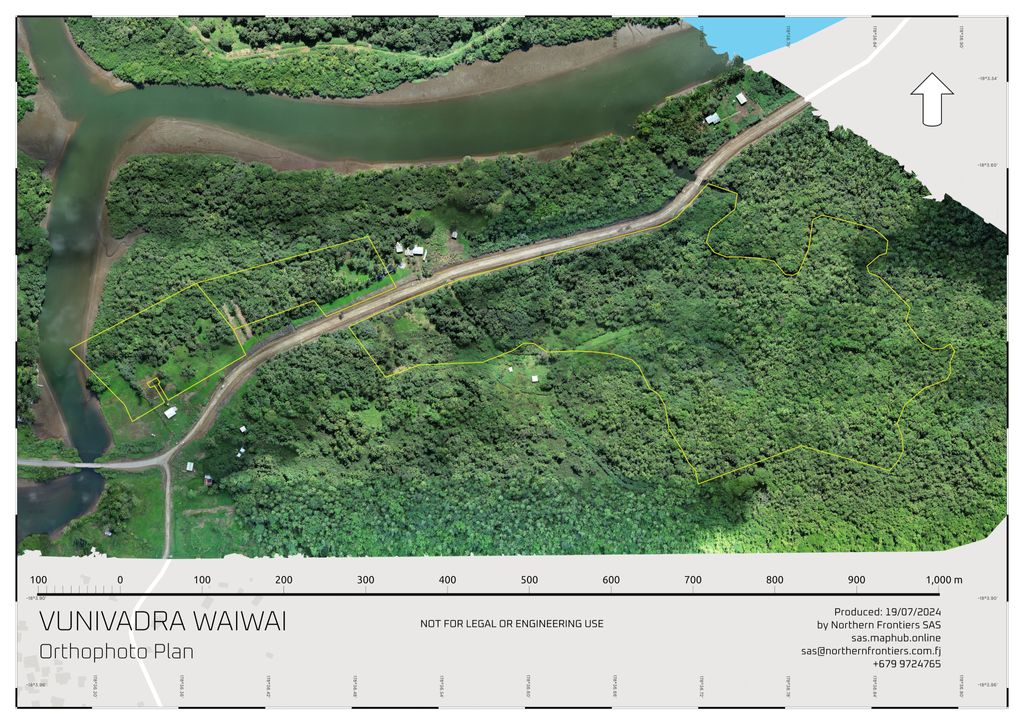
Particularly for this project we got a set of 3 geo-referenced aerial maps.
1. Orthophoto Plan - is an actual visual high resolution picture with ground sampling distance (GSD) of 2.7 cm / per pixel. It is literally mean that the most little details that could be recognised on the ground would be just 2.7 cm in size.
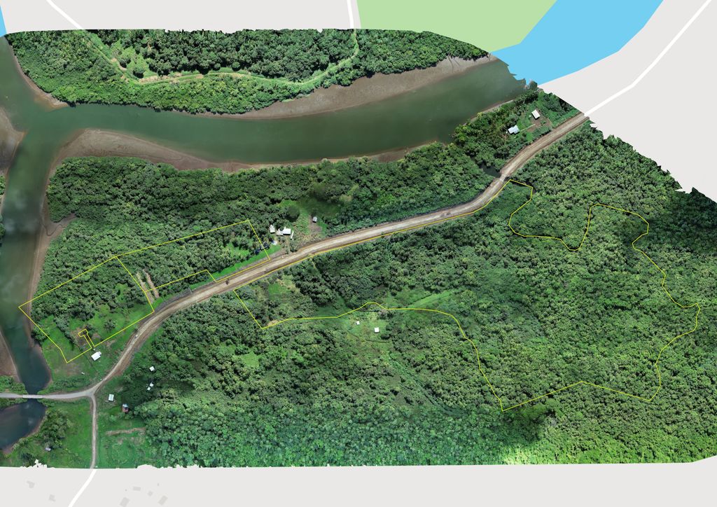
The Orthophoto plan or map can also contain land boundaries and various markings, measurements etc.
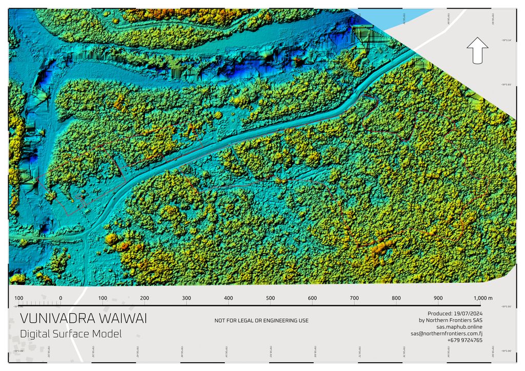
2. Digital Surface Model - this model, as a raw image comes pretty useless for human eye to read and understand and look more like an x-ray film only doctors understand. Usually it looks like this.
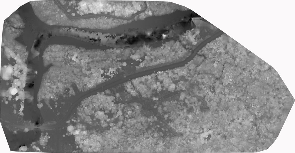
And we turn it a bit more user friendly for an ordinary human viewer.
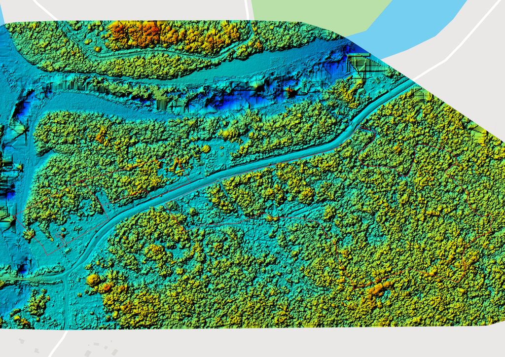
Digital Surface Model make it easier to understand the distribution of vegetation and it's size over the area of interest. It helps to plan area development more efficiently and provides other invaluable insights for data driven decision making.
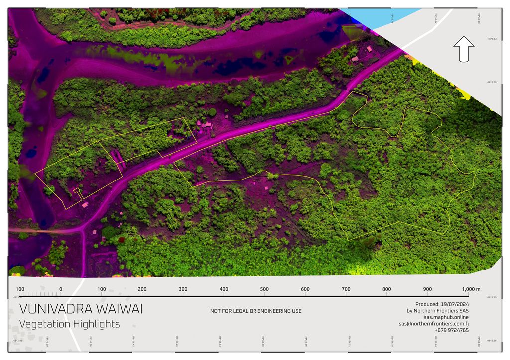
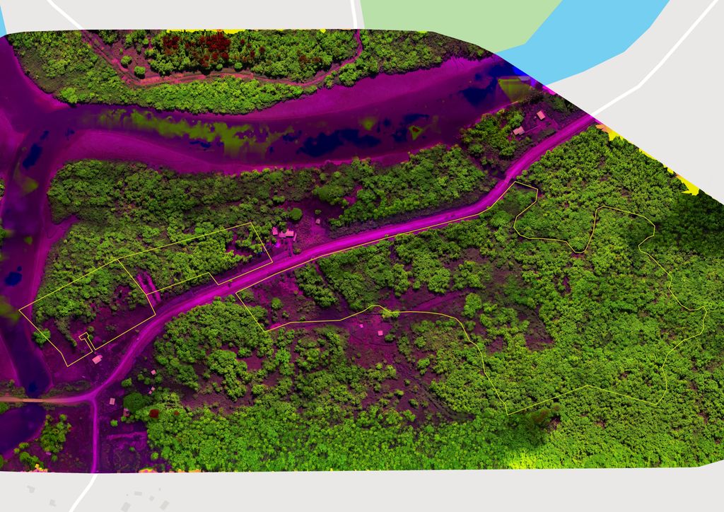
3. Tall vegetation and trees highlights
And to make it even more descriptive we blend Orthophoto map with Digital Surface Model where bare ground and low growing vegetation painted intense purple colour for better contrast and taller vegetation and trees gradually turn purple colour to green and bright green the taller they go. Such colouring helps to better understand the distribution and concentration of tall vegetation over the land.
Stage 5: Reports and documentation
And at the last stage we produce basic documentation that covers our entire work and might be needed for a licensed surveyor to certify the deliverables in order they could be used for legal or engineering purpose as a supporting documentation.
Typical reporting includes map processing software quality reports and printable mapping deliverables for the client that usually provided as a set of PDF files along with mapping materials shared through MapHub and other downloadable raw materials and data that client can use themselves or provide to whoever else might need them to assist them with further work.