In the most advanced and cost effective data driven way
Get to know your land better
Aerial mapping serves simply invaluable insights to a property owner or real estate investor.
We produce high resolution and geographically accurately referenced photo maps for real estate industry, investors and land owners.
Our very own maps hosting facility MapHub is a unique, internationally used online service, that makes sharing maps and geographically referenced details easy for an ordinary person.
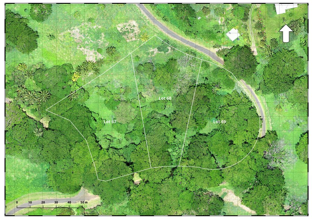
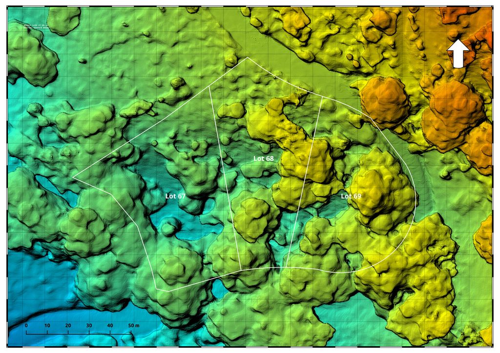
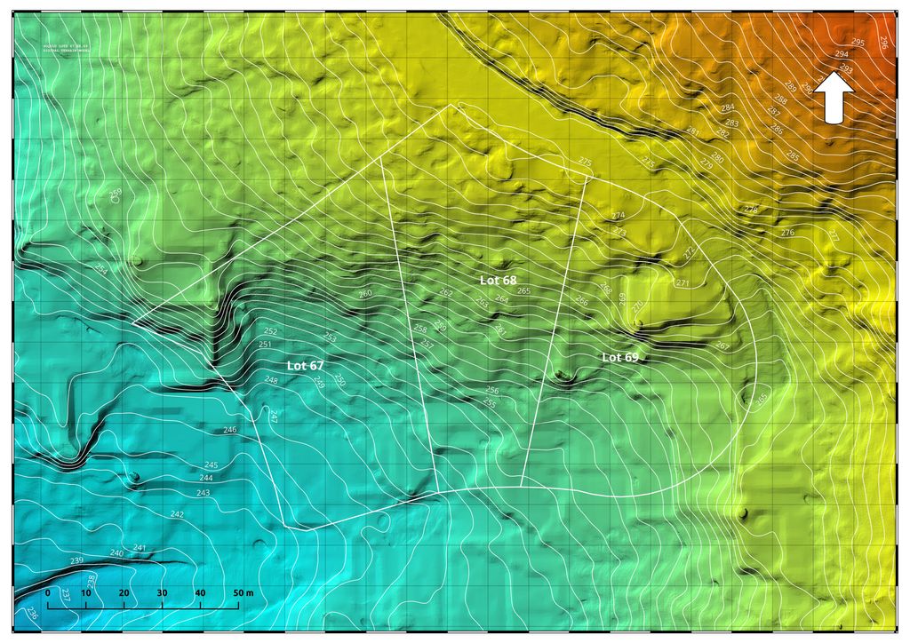
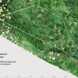
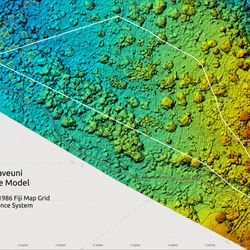
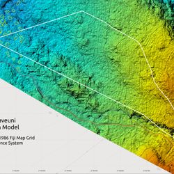
Soqulu, Taveuni, Fiji
We were approached by the property owner representative, with the request to produce observational aerial video and photo images for the US based client. The client also wanted to know actual surface and terrain profile of their newly purchased property so they could worh through the ideas of how to develop it.
This map was created in MapHub. You can open it in a separate window for detailed and more comfortable viewing.
Mango Bay Resort
Test mapping done over Mango Bay resort in January 2022 before it's reopening after COVID pandemic. Tap "View this map in MapHub" button to see it in full.
This map was created in MapHub. You can open it in a separate window for detailed and more comfortable viewing.
Waimanu Quarry, Suva
Waimanu Quarry, Flame Tree
This map was created in MapHub. You can open it in a separate window for detailed and more comfortable viewing.
Nakia Resort Taveuni and adjacent properties
The map of a residential lots next to Nakia Resort. Zoom in and out or open it in MapHub to see the whole map.
This map was created in MapHub. You can open it in a separate window for detailed and more comfortable viewing.
South Taveuni
300 acres land parcel on Taveuni, taken and held by squatters. The map was produced for court and bailiffs to locate squatters unregistered households in order to deliver eviction notices.
This map was created in MapHub. You can open it in a separate window for detailed and more comfortable viewing.
Vacala Beach, Taveuni
20 acres lot of land in Taveuni for sale. (yellow boundaries) Use zoom buttons to view it in details and contact us if interested.
This map was created in MapHub. You can open it in a separate window for detailed and more comfortable viewing.
Veisamudu, Naqara, Taveuni
iTaukei Native Land mapping project Project completed in March - April 2024 for land development planners. Aerial photo map of the area with geo-referenced tracing of houses, roads and rivers, processing surface and terrain models for planning subdivisions purpose.
This map was created in MapHub. You can open it in a separate window for detailed and more comfortable viewing.
Veisamudu Project Deliverables
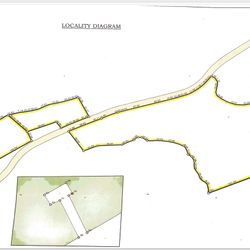
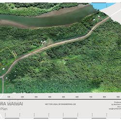
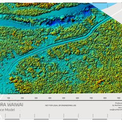
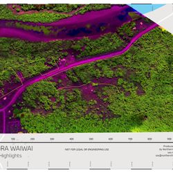
Vunivadra Waiwai, Nausori, Central Division, Viti Levu
iTaukei Native Land mapping project. Project includes digitizing of old surveyor plans and land boundaries, overlaying land boundaries, producing ortphophoto plan and vegetation highlight based on data collected
This map was created in MapHub. You can open it in a separate window for detailed and more comfortable viewing.
Vunivadra Waiwai Deliverables