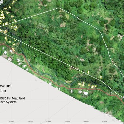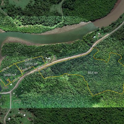
Fiji iTaukei Native land aerial mapping
Owners or lessee of a relatively large parcels of native land in Fiji often have difficulty understanding what their land actually is, how much of suitable for agriculture land they have, what crops they can plant there and where, how much valuable timber might be there or what the terrain like. In some cases it is not an easy task at all or sometimes simply not possible to do such assessment from the ground as some parts of the land simply are not accessible by car or on foot and that is where the aerial drone survey comes absolutely invaluable. Being the most cost and effort efficient way to understand the land.