Who we are
We are a small team of GIS and unmanned aviation professionals based in Fiji and overseas, providing various GIS and professional drone services for individuals, island communities, government agencies and businesses in Fiji and beyond.
What we do
Harnessing fusion of drones and information technology, we supply our clients in Fiji and abroad with accurate geospatial data and aerial visuals, assisting in making well-informed investment, development, legal and marketing decisions.
Professional Drone Services in Fiji
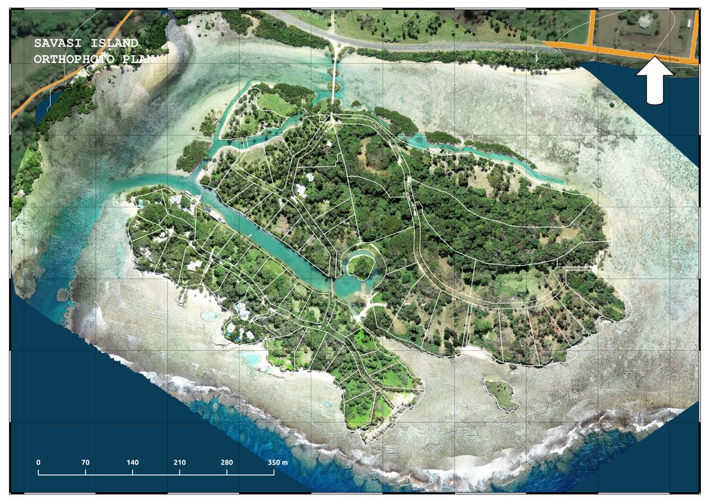
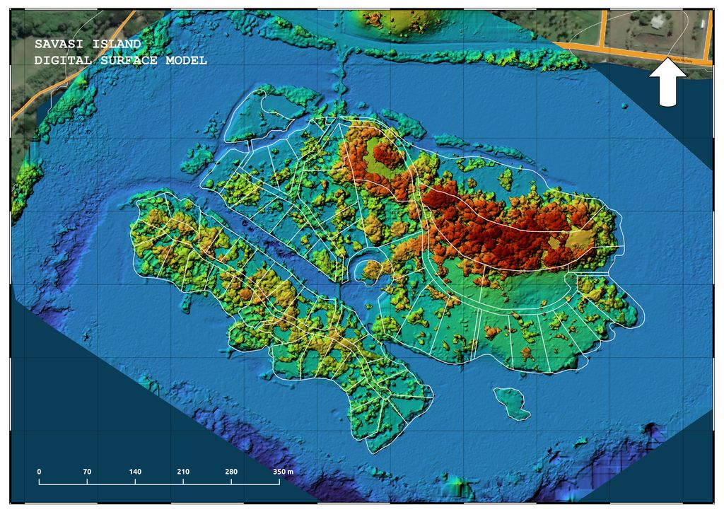
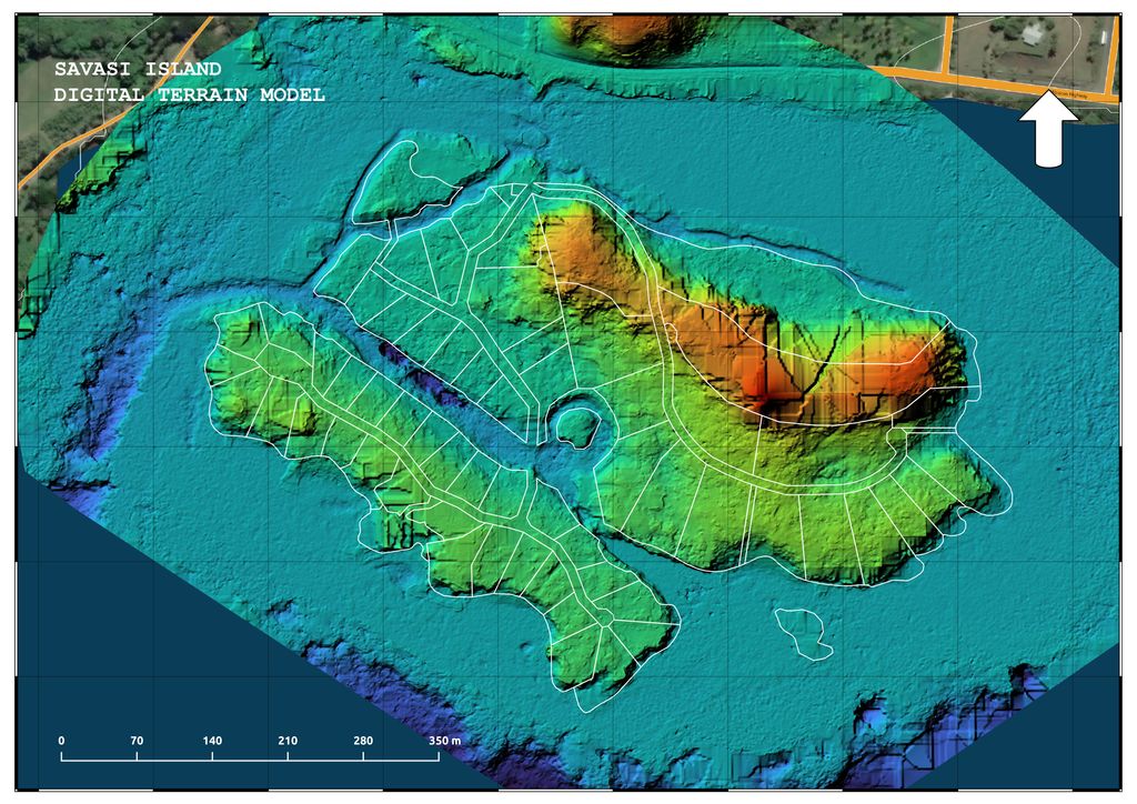
Aerial mapping
Aerial mapping and remote sensing provide a high-resolution, geographically referenced views of land and structures, assisting with better informed decision-making and planning. It also helps to detect various on the ground activities and perform high accuracy measurements of land, saving significant amount of time and resources, compared to more traditional ways.
Aerial mapping and remote sensing come incredibly useful for land owners, farmers, construction companies, and real estate professionals in Fiji, greatly reducing time and costs spent on geospatial analysis, understanding the terrain, preparing various data based presentations and documentation.
Aerial inspections
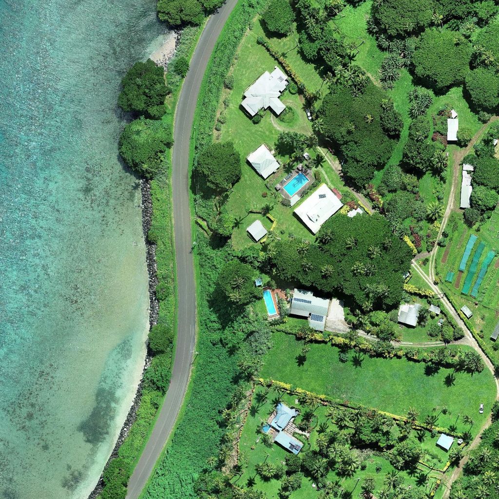
Aerial inspections offer a unique perspective for real estate and land owners prodiving them with high-quality photo and video visuals from multiple angles and distances.
It comes particularly useful when access to the property or parts of it appears to be difficult or sometimes simply impossible from the ground. It also helps our clients based overseas to monitor their Fiji real estate portfolio having regular updates on property conditions and on the ground changes.
Visual aerial inspections, performed in combination with aerial mapping. is a highly versatile tool, that benefits various industries, providing cost-effective solution for smart property management, strategical look inspections, construction progress monitoring and well informed decision making.
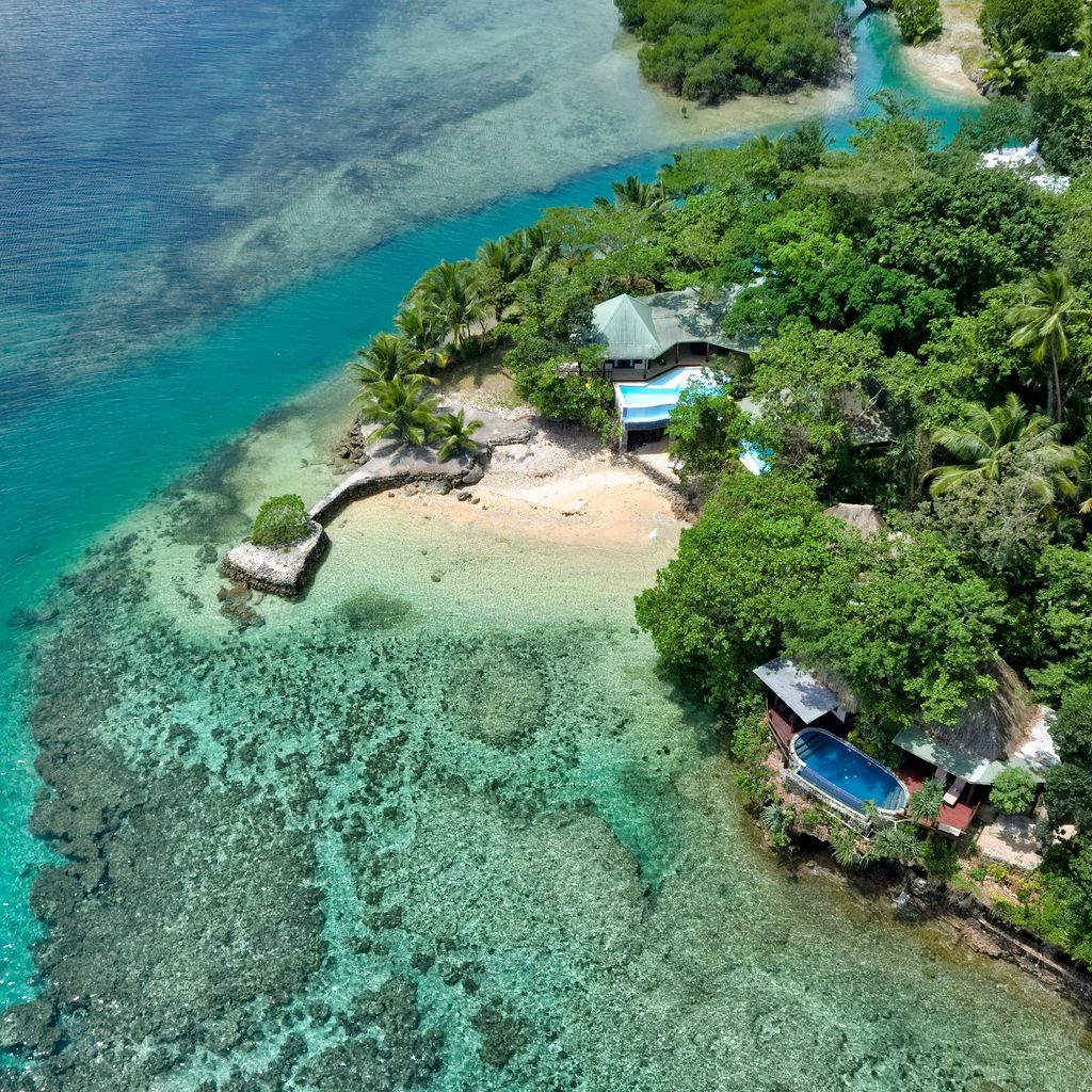
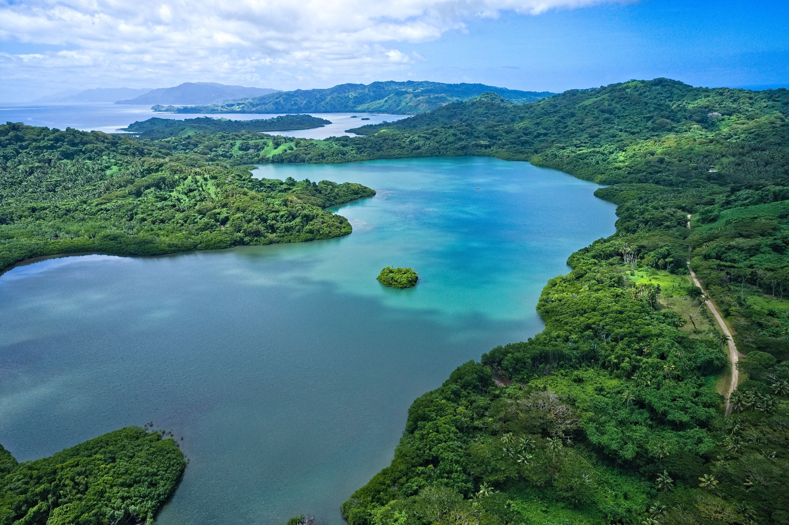
Real Estate Marketing
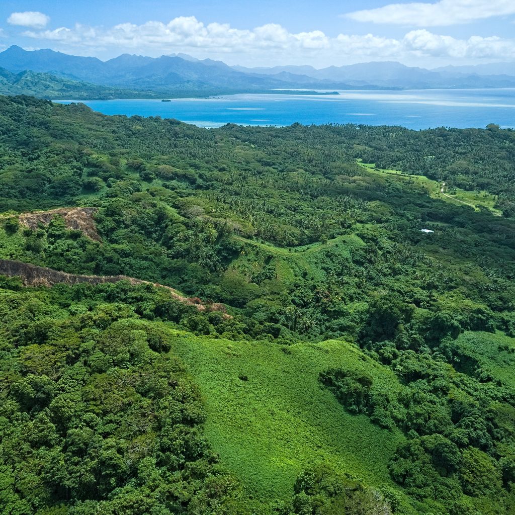
Marketing a property, especially large in scale and value, is a daunting task, as it requires highlighting the property's unique features to potential buyers who usually have literally only couple of minutes to get themselves interested and if they don't they leave and you don't see them again.
Promotional aerial video and photo materials are a captivating way to showcase property's features, its surroundings and stunning views.
Through the years we accumulated invaluable experience in showcasing real estate the right way. From individual houses to 5 star private islands and hundreds of hectares land parcels.
Our service also help potential buyers to understand better the property's location and surroundings. Where is it? What is around? How actually far is this and that? Our real estate marketing media greatly helps buyers envision themselves in the area and make an informed decision about it's suitability.
As a professional drone service, we offer various packages catering to different clients. Some packages may include a simple flyover video, while others may offer more in-depth footage or even fully featured real estate web presentation. Here are some examples Savasi Island, Natewa Bay Resort